|
mileage
|
|
|
0
|
Mr. Roberts drove us up to the intersection of Bell School
Line and Number Two Side Road. Here we started walking. We
planned to go to Kelso Dam. |
|
0.7
|
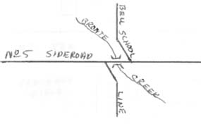
We crossed a branch of Bronte Creek. The flood
land on both sides of the creek at this point were perhaps 0.1 mile from
band to bank, and the entrenched meanders which are so prevalent farther
down the river (e.g. between No. 1 Side Road and Upper Middle Road) were
not seen. |
|
3
|
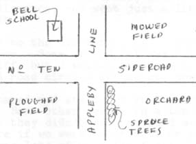
We came to No. 5 Side Road. The Bell School Line
jogs to the west a little below No. 5 Side Road; and a little to the east
above No. 5 Side Road. (See map) We followed No. 5 Side Road
for a hundred yards or so. This jog in the road is to avoid two bridges
across the creek. (The same creek we crossed at 0.7 miles.) |
| |
|
|
4
|
We left the road to investigate an abandoned farm house. |
|
4.6
|
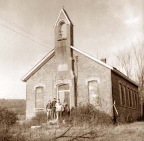
We came to No. Ten Side Road. On the westerly corner
of the intersection stood the now abandoned Bell School. The bell
from the tower was missing. We got inside the school from the rear,
but there was nothing to see inside anyway. It was pretty run down
inside. When we came out again, I took the following picture: |