 |
|
from Mr. Doug Carr dated February 26, 2003. |
This page was posted by Robert Sewell on Monday, March
3, 2003;
and was last modified on Friday, April 4, 2003.
|
|
|
from Mr. Doug Carr dated February 26, 2003. |
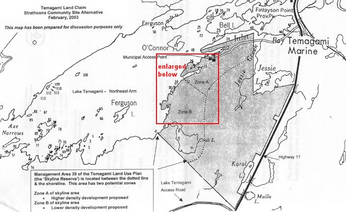
The following enlargement illustrates the terrain over
a small portion of the proposed site extending from the waters edge approximately
400 metres inland. I have wandered around this area for the past
thirty years during the late spring, summer and early autumn, and I would
describe this area as having many small swampy sections with rough, steep
rocky sections between the wet areas.
| I am familiar with only a small portion of the proposed
settlement area, but I have no reason to believe any of the area is any
"better" than this part.
This part appears to be entirely unsuitable for development. Many small rocky areas are not shown on this map and only the main large swampy areas are shown. The steep slope can be seen from the lake. Long time resident Mr. Len Cunningham, a prospector from Kirland Lake, describes the area as "very rocky - much bedrock with a thin impermeable soil cover - very irregular relief with swamp between outcrop areas. A difficult and costly area to develop. Poorly drained" It is very difficult to imagine how sewage and grey water from any dwellings would be dealt with. Removing waste by truck or barge would be costly. |
 |
| My purpose in posting this
page is to illustrate the rationale behind my request for conducting a
full environmental assessment or review before this proposal goes any further.
Please contact Robert
Sewell
|