|
|
 |
|
|
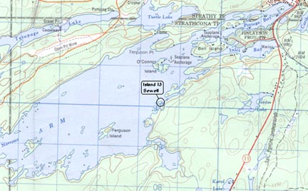 |
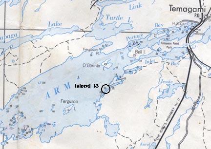
Island 13 is located at approximately:
West Longitude 79º 50' 4"
North Latitude 47º 2' 25"
I hope have expressed this correctly, or at least in a form that others can understand. Please see the following maps as well.
The top map is from the old Department of Lands and Forests
"Map 24C Islands in Lake Temagami" and the lower map is from the Temagami
Ontario 1:50,000 topographical map 31 M/4
|
|
|
|
|
|
|
|
|
|
 |
Be sure to visit more Sewell Pages.